Wildfire Information Update
First off, thank you to firefighters and Forest Service. Firefighting is hard, dangerous work. During 100 years of fighting fires, the Forest Service continues to learn and adapt to change.
The purpose of this web page is to summarize personal observations of recent wildfires in North Central Washington.
Recent Fire Maps

|
Diamond Creek Fire progression map, from September 1 to 5, 2017. This map shows the fire progression between September 1 and 5, 2017. At this point, the total burn perimeter is over 105,000 acres, with the most significant recent growth in the Ashnola drainage across the international border. There was also a large area of upper Monument Creek that burned southward against the prevailing wind, and possibly in conjunction with a burnout fireline to protect further movement toward Mazama. |
|
Diamond Creek Fire progression map, ca September 1, 2017. This map shows the fire progression for August to September, 2017. At this point, the total size of the burned area was between 50,000 and 60,000 acres. |

|
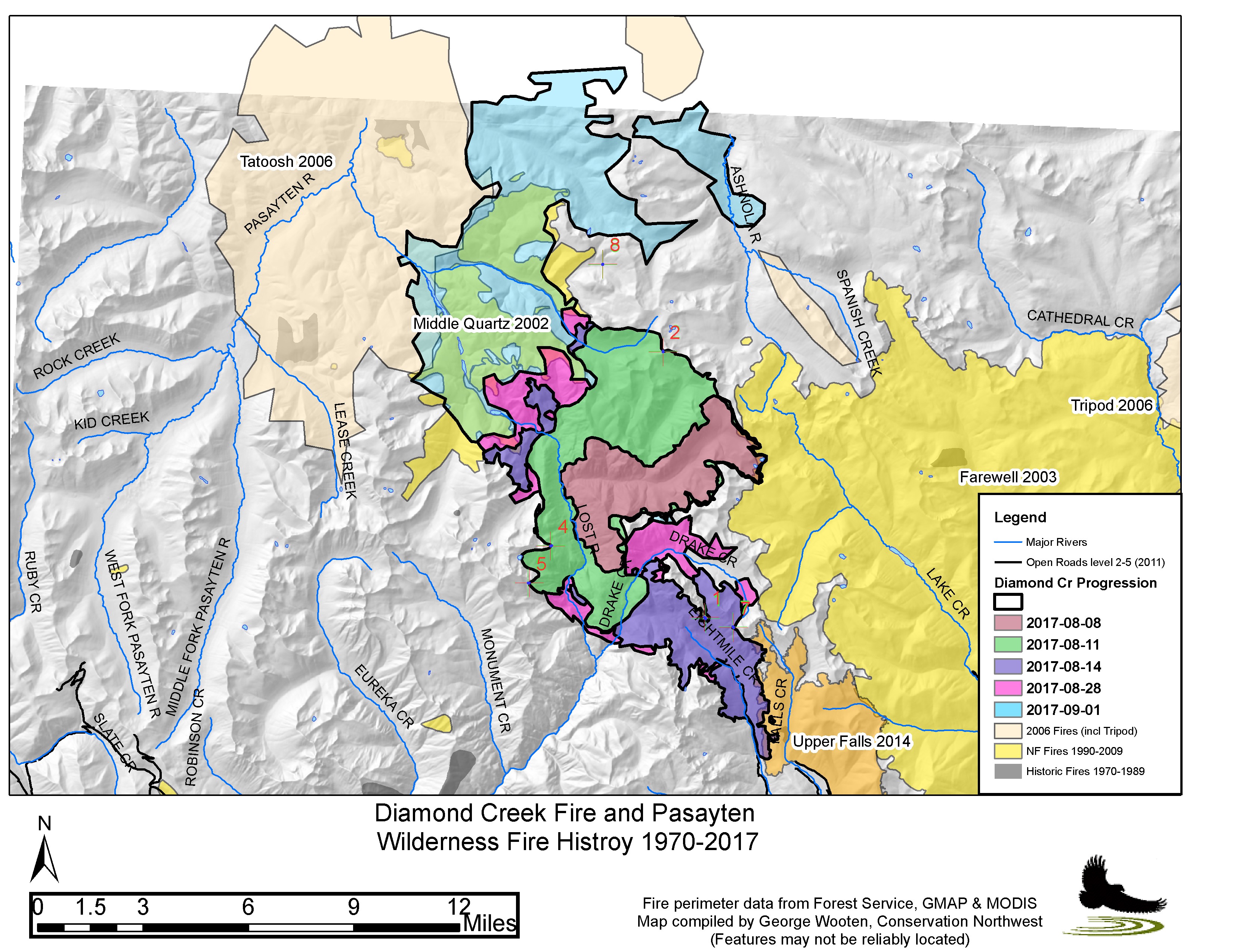
Diamond Creek Fire area fire history. This map shows historic fire perimeters from the 1920s onward overlaid on the Diamond Creek Fire perimeters ca Sept 1, 2017. A hike to this area before the fire revealed old burned logs on every inch of ground. Fires normally burn here every 100 years or so. The last big fires were in the 1920s, so Diamond Creek is within its normal fire regime, even though it was started by a match. |

|
Map of Upper Methow Valley fires 1970-2017. This map shows historic fire perimeters in the Diamond Creek area dating from 1970 onward. It also shows some of the recent Forest Service fuel reduction projects, as well as forest canopy cover. |

|
Current wildland fire map by gmap4 |
2014 and 2015 Fires
Notes on the 2015 fires. This focuses on the Chelan fires.
Notes on the 2014 fires. This focuses on smoke management.
